
Stay updated with the latest indian-regional-navigation-satellite-system news, articles, and insights from trusted sources. Explore in-depth coverage and expert analysis on indian-regional-navigation-satellite-system topics.

The Indian Space Research Organisation (Isro) announced on Thursday that it is inviting proposals from the Indian solar physics community to access data from the Aditya-L1 mission, the first space-based Indian mission to study the Sun. This is the second such formal call from Isro for Indian scientists to access the Aditya-L1 mission data; the first call was made in January. "At present, there are over 27 TB of data in the public domain, and several important scientific results have been publi ...Read More >

The Indian Air Force on Wednesday successfully tested the Military Combat Parachute System (MCPS) in a combat freefall jump from an altitude of 32,000 feet, the Ministry of Defence said in a release. The parachute, indigenously developed by DRDO, is the only system currently in operational use by the Indian armed forces capable of deployment above 25,000 feet. The MCPS was developed by DRDO laboratories - Aerial Delivery Research and Development Establishment, Agra and Defence Bioengineering a ...Read More >
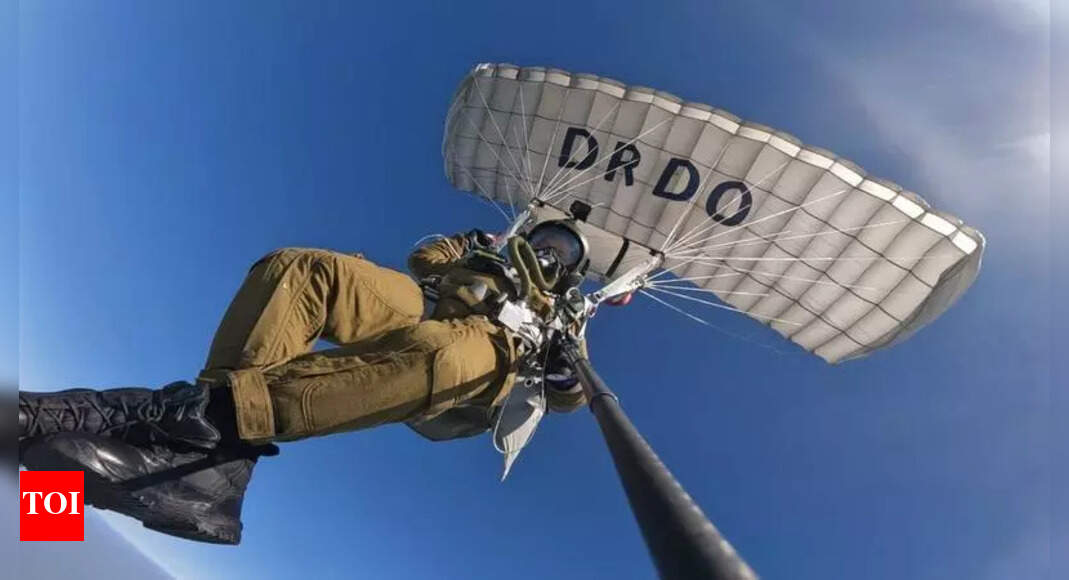

Lucknow: The Defence Research and Development Organisation (DRDO) has successfully tested an indigenously developed Military Combat Parachute System (MCPS) at an altitude of 32,000 feet.The high-altitude combat freefall was carried out by Wing Commander Vishal Lakhesh, VM (G), along with Master Warrant Officers R J Singh and Vivek Tiwari. The MCPS, jointly developed by DRDO's Aerial Delivery Research and Development Establishment (ADRDE), Agra, and Defence Bio-Engineering and Electromedical Labo ...Read More >

New Delhi, Oct 15 (PTI) A military combat parachute system, indigenously developed by the DRDO, has been "successfully" tested at an altitude of 32,000 ft, opening doors for induction of indigenous parachute systems, officials said on Wednesday. This achievement makes the military combat parachute system (MCPS), the only parachute system currently in operational use by the Indian armed forces, capable of deployment above 25,000 ft, the defence ministry said. The MCPS was developed by DRDO labo ...Read More >

ISRO is developing a massive rocket, equivalent to a 40-story building, capable of launching 75,000 kg satellites into low earth orbit, according to Chairman V Narayanan. This year's agenda includes NAVIC satellites, the N1 rocket, and launching a US communication satellite. India aims to triple its current 55 satellites in orbit within the next three to four years. Indian Space Research Organisation (ISRO) Chairman V Narayanan on Tuesday said the agency is developing a rocket as tall as a 40-s ...Read More >

New Delhi, India: India's indigenous navigation system, Navigation with Indian Constellation (NavIC), continues to strengthen its capabilities with the introduction of second-generation satellites. NavIC, India's independent regional navigation satellite system, is designed to provide accurate Position, Velocity, and Timing (PVT) services across India and a region extending 1,500 km beyond its borders, ensuring strategic independence in satellite navigation. 1. Standard Positioning Service (SP ...Read More >

India is nearly self-reliant in data for strategic applications due to NavIC, its satellite navigation system similar to GPS, according to In-SPACe Chairman Pawan Goenka. NavIC ensures independence for strategic needs and will coexist with other systems. India is also increasing its own communication satellites but still relies partly on foreign ones.In-SPACe Chairman Pawan Goenka said on Tuesday that India is almost self-reliant in data required for strategic applications, thanks to NavIC, the ...Read More >
Stay updated with the latest None news, articles, and insights from trusted sources. Explore in-depth coverage and expert analysis on None topics.